The South African Weather Service (SAWS) has issued a warning about an intense cold front expected to affect large parts of South Africa from Wednesday, 25 June to Friday, 27 June 2025.
SAWS warns of intense cold front coming this week
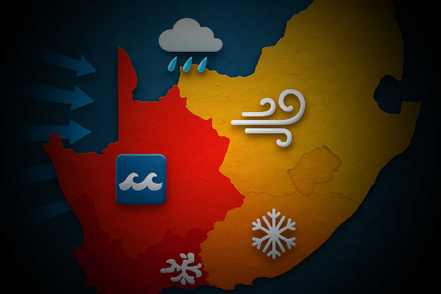
The cold front is forecast to bring harsh weather, including heavy rain, strong winds, very cold temperatures, and rough seas.
Where and when the cold front will hit
The weather system will first reach the south-western parts of the country on Wednesday, mainly affecting the Namakwa District in the Northern Cape and the Western Cape.
As it moves east, it will affect the Eastern Cape and interior parts of eastern provinces on Thursday and Friday.
People living in these areas should prepare for very cold and wet conditions.
The SAWS said heavy rainfall is expected, especially in low-lying parts of the Western Cape, which may lead to localised flooding. Roads in these areas may become slippery, making driving dangerous.
“Wet and slippery roads may result in dangerous driving conditions. Motorists should exercise caution and adhere to safety measures,” the SAWS warned.
Risks from wind and snow
In addition to the rain, strong and gusty winds are predicted across the interior. These winds can damage buildings, uproot trees, and make travel hazardous. There is also a chance of snowfall in the mountain ranges of the Western Cape and the south-western interior of the Northern Cape.
The Eastern Cape, which has recently faced severe flooding, is also expected to be hit hard by the wind. Damaging winds are forecast across most parts of the province on Thursday.
Daytime temperatures will drop to cold or very cold levels over large areas, especially in high-lying inland regions.
Maritime concerns: rough seas and gale-force winds
The cold front will also have a serious impact on the sea. Gale-force winds and very rough seas, with waves between 5.5 and 7.5 metres high, are expected along the coastlines of the Northern and Western Cape.
This could disrupt fishing, port operations, and make conditions dangerous for boats and beachgoers.
The SAWS advised coastal residents and those at sea to be extremely careful.
With cold, wet, and windy conditions on the way, residents are urged to stay indoors where possible, keep warm, and follow official instructions to stay safe during this period.